-
E-mail
1769283299@qq.com
-
Phone
15666889252
-
Address
Room 110, 1st Floor, Workshop 3, Oulong Technology Park, No.1 Jinma Road, Yuqing Community, Xincheng Street, Weifang High tech Zone, Shandong Province
Shandong Boke Instrument Co., Ltd
Soil and Water Loss Monitoring System: Multi dimensional Data Collection Helps Ensure Regional Ecological Security
Date: 2025-12-10Read: 26
Soil and Water Loss Monitoring System: Multi dimensional Data Collection Helps Ensure Regional Ecological Security BK-JL2 Shandong Boke Instrument Manufacturer is continuously updating. Soil and water loss, as a global ecological crisis, is quietly eroding land productivity and ecological balance, threatening regional ecological security and sustainable development. The soil erosion monitoring system, with its multi-dimensional data collection capability, has become a key tool for accurately identifying erosion risks, scientifically formulating governance strategies, and dynamically evaluating ecological effectiveness, building a solid defense line for regional ecological security.
Multi source data fusion to construct a three-dimensional monitoring network
The system integrates satellite remote sensing, unmanned aerial vehicle inspections, ground sensors, and manual survey data to form a four in one monitoring system of "sky, earth, and man". Satellite remote sensing covers large-scale surface changes and accurately identifies erosion channels and exposed areas; Drones are equipped with high-resolution cameras and LiDAR to capture micro terrain and vegetation coverage details on slopes; Real time monitoring of soil moisture, slope, rainfall erosivity and other parameters by ground sensors; Artificial surveys supplement key information such as vegetation types and land use patterns. For example, in a certain watershed on the Loess Plateau, the system found through multi-source data fusion that the erosion amount of sloping farmland is five times that of forest land, providing a scientific basis for promoting terrace transformation.
Dynamic warning, prevention in advance
Based on real-time data collection, the system constructs an erosion risk warning model, which automatically triggers warnings when indicators such as soil erosion modulus and runoff sediment concentration exceed thresholds. In a small watershed in the upper reaches of the Yangtze River, the system detected a sudden increase in soil moisture and a decrease in vegetation coverage in a certain section of the slope protection after continuous heavy rainfall. Early warning information was immediately pushed, and maintenance personnel reinforced the slope protection in a timely manner, avoiding landslide disasters and ensuring the safety of downstream villages.
Scientific evaluation and optimization of governance strategies
Long term monitoring data provides quantitative support for evaluating governance effectiveness. The system dynamically adjusts control measures by comparing indicators such as soil erosion and vegetation restoration before and after treatment. In the southern red soil region, data shows that the "equal height grass belt+green manure coverage" model can reduce surface runoff by 35%. This model has been promoted to multiple provinces across the country, promoting the transformation of soil and water conservation towards precision and ecology.
The soil erosion monitoring system is based on multidimensional data and provides a full chain support of "perception warning assessment" for regional ecological security, becoming the "smart eye" for safeguarding green mountains and rivers.
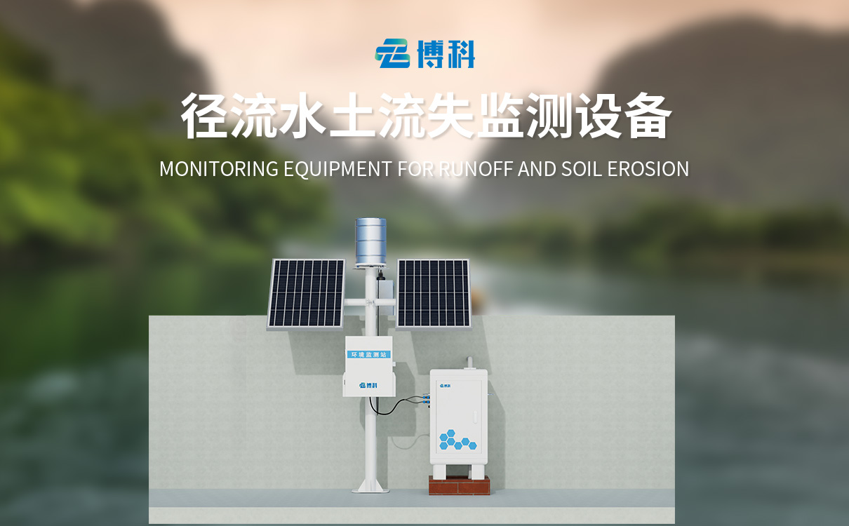
1、 Product Introduction
In the monitoring of soil erosion in runoff fields and small watersheds, traditional manual measurement of flow and sediment data has the problems of large workload and low efficiency, as well as high labor costs and large data errors. The automatic monitoring system for soil erosion has undergone years of technological breakthroughs and extensive field experiments, successfully revolutionizing the traditional manual monitoring mode.
This system consists of a data acquisition controller, sediment concentration measurement sensor, open channel flow sensor, and rainfall sensor. Among them, the open channel flow sensor component can automatically measure the runoff flow and accurately calculate the total runoff and instantaneous runoff data at different time periods through the controller; The sediment concentration measurement sensor collects real-time sediment concentration data based on the characteristics of runoff changes at sediment measurement ports with vertical distribution of runoff; The rainfall sensor is responsible for accurately obtaining cumulative rainfall data. The collaborative operation of various sensors and the collected data have critical value for soil erosion analysis.
The system uploads real-time sediment content, runoff, and accumulated rainfall data collected by various sensors to the cloud platform, making it easy for users to access, analyze, and manage data anytime and anywhere, providing scientific and accurate data support for soil and water conservation decisions.
Workflow of sediment content sensor: Surface water enters an open channel or Bacher trough through a water diversion channel and passes through an open channel flowmeter to obtain instantaneous runoff data, and calculates the total runoff per unit time. The surface water is collected by a water diversion pipe and sent to the main water tank. When the surface water capacity of the main water tank is sufficient for detection, the system starts and sends the surface water to be measured to the sample bin for detection. The sensor sends the collected data to the processor for processing to obtain sediment content. After obtaining the data, the sensor discharges the internal sample through the drainage pipe to prepare for the next sampling. The processor outputs to external devices through 485.