-
Phone
13910499766
-
Address
Building 5, Guanghua Entrepreneurship Park, No. 18 Anningzhuang East Road, Haidian District, Beijing
Product Categories
- Fourier transform infrared spectroscopy measurement
- Plant measurement
- Monitoring and Sampling of Gas Particulate Matter
- Spectral measurement of ground objects
- Soil measurement
- Water quality and quantity measurement
- Meteorological and flux monitoring
- UAV
- Environmental air quality gas monitoring
- Trace gas measurement
- Hyperspectral imaging measurement
- other
Beijing Lijia United Technology Co., Ltd
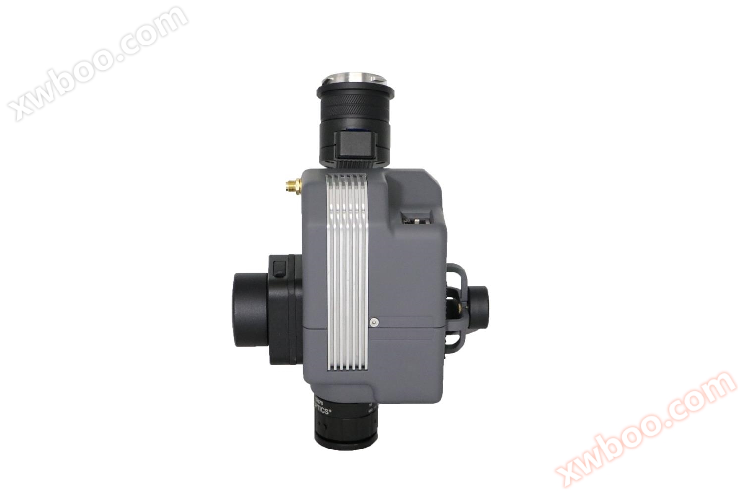
300-TC airborne hyperspectral imaging system
NegotiableUpdate on 03/19
- Model
- Nature of the Manufacturer
- Producers
- Product Category
- Place of Origin
Overview
300-TC is an unmanned aerial remote sensing hyperspectral imaging system independently developed by iResearch
Product Details
300-TC is an unmanned aerial remote sensing hyperspectral imaging system independently developed by iResearch. The system consists of an imaging spectrometer, lens, inertial navigation system, and flight computer.

characteristic
The lightweight whole system includes a shell weight of only 360g, compatible with DJI's X-Port gimbal system, and a total gimbal weight of no more than 710g;
The compact overall system volume is 110 * 75 * 70mm (excluding lens);
Efficient and perfectly compatible with DJIM300 and M350 series unmanned aerial vehicles with dual mounting, easy to carry, simple to operate, stable and reliable, and excellent flight time;
● Compatible with M300 dual mounting function, can be used simultaneously with other M300 sensors, and has considerable performance;
Powerful spectral range of 400-1000nm, with 300 spectral channels and 1200 spatial channels;

TECHNICAL INDEX
hyperspectral imager
Spectral range: 400-1000 nm
Number of spectral channels: 300
Number of spatial channels: 1200
Maximum frame rate: 300 Hz
● Built in inertial navigation: GPS+Mems IMU+Kalman filtering algorithm
Pitch/Roll accuracy: better than 0.03 °
● Heading accuracy: better than 0.1 °
Output frequency: 1000Hz
Weight: 400g
● Volume: 110 * 75 * 70mm (excluding lens)
Power consumption: 15W
● Suitable for DJI Xport gimbal
Suitable for dual mounting of DJIM300 and M350 series drones
Technical specifications of Mega Cube image data processing software
Equipped with radiation correction function, it can be calibrated through the radiation calibration file of the hyperspectral imaging instrumentAutomatically complete radiation correction.
● With orthorectified function, it can complete the correction of flat ground models without digital elevation modelsRadiometric calibration and digital elevation model calibration with digital elevation models can be completedMatching of digital elevation models for pixel by pixel hyperspectral images.
● It has the function of automatically calculating the reflectance of airborne hyperspectral imaging based on spectral data from ground spectrometers, which can automatically match and calculate the reflectance per secondThe matching accuracy is better than 1 millisecond, ensuring data accuracy in weather conditions with varying light intensity.
● It has the function of calculating reflectivity based on ground targets, and can simultaneously process multi voyage airborne data and multi target calibration data.
One click completion of energy calibration, geometric correction, and orthorectified hyperspectral imaging data.