-
Phone
13910499766
-
Address
Building 5, Guanghua Entrepreneurship Park, No. 18 Anningzhuang East Road, Haidian District, Beijing
Product Categories
- Fourier transform infrared spectroscopy measurement
- Plant measurement
- Monitoring and Sampling of Gas Particulate Matter
- Spectral measurement of ground objects
- Soil measurement
- Water quality and quantity measurement
- Meteorological and flux monitoring
- UAV
- Environmental air quality gas monitoring
- Trace gas measurement
- Hyperspectral imaging measurement
- other
Beijing Lijia United Technology Co., Ltd
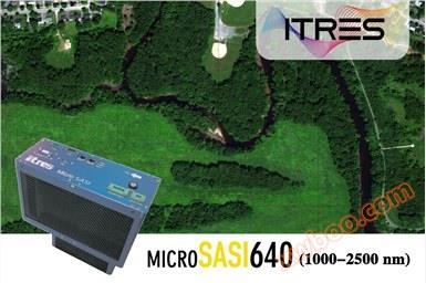
MicroSASI640 Miniature Hyperspectral Imager
NegotiableUpdate on 03/19
- Model
- Nature of the Manufacturer
- Producers
- Product Category
- Place of Origin
Overview
Internal cooling and calibration system
Product Details

characteristic:
1. Miniature shortwave infrared hyperspectral imaging instrument, suitable for unmanned aerial vehicles and outdoor environments
2. Spectral coverage range: 1000-2500 nm, number of spectral channels: 256
3. Field of view angle: 40 °
4. Number of spatial pixels: 640
5. Optical lenses that restrict spectral diffraction
6. Optional front optical lens
7. Comes with a built-in camera and data recording system
8. Internal calibration system
9. Internal cooling mechanism
10. Optional GPS/IMU
11. Simple LiDAR integration
12. Remote control through radio or self-service control through waypoints
13. Time synchronization with external instruments
14. Provide API for custom development

Application areas:
Target detection and synthetic material mapping, classification, geological exploration, plant species identification, water pollution monitoring, public facility corridor mapping, mineral exploration

Performance indicators:
| PRODUCT MODEL | micro SASI 640 |
| Spectral coverage range | 1000-2500 nm |
| #Spectral channel | 256 |
| refrigeration system | Cryo cooler |
| #Number of lateral pixels | 640±3% |
| Full field of view angle | 40 degrees |
| Instantaneous field of view angle | 1.8 mRad (0.1 °) |
| aperture | f/2.5 |
| Spectral sampling width | 5.8 nm |
| spectral resolution | <8.5 nm |
| pixel size | 15 Microns |
| dynamic range | 14-bits |
| Detector filled well | 500000 Me |
| data rate | ≥ 150 FPS |
| Spectral Smile/Keystone | ≤ ±0.35 pixels |
| Spot size | <1.5 |
| Calibration accuracy | ≤ 2% (NIST-Traceable) |
| Data recording ability | 1 TB (SSD, SATA III) 12 hrs @ 50 fps 5.0 hours @ 150 fps |
| Size (cm) | 10 x 23 x 25 |
| weight | 3.8 Kg |
| power consumption | 24-32 VDC, 70 W |
operate
1. Operation method: Remote control through laptop and R/F, or pre-set route and waypoint
2. Multi sensor operation mode: Simultaneously operate 5 ITRES hyperspectral imagers through the MuSIC system
Data interface, timestamp, remote operation
1. GigE or USB-3
2. TTL input for waypoint triggering
3. Pre set coordinate automatic control (requires MEMS intrinsic: accept. shp,. kml, etc.)
4. Time synchronization with external instruments
5. Available APIs
data processing system
1. Operating software based on Linux or Windows
2. Playback software (quick view)
3. Generate data in 16-32-bit BIP format compatible with ENVI (such as BIL, BSQ format)
Geometric correction system
1. GNSS or MEMS inertial navigation integration (optional)
2. Data synchronization system (GPS, attitude,&image streams, if INS used)
Geometric correction/orthorectified/image stitching software
1. Accept Lidar, Ifsar, and USGS DEM data input
2.Adopting neighborhood algorithm to ensure the authenticity of radiation information

Manufacturer: ITRES Canada